Step 1 :- Create New Android Project.
Step 2 :- Add Google-play-services_lib to your project.
Step 3 :- Open AndroidManifest.xml file.
<!--?xml version="1.0" encoding="utf-8"?--> package="com.mapv2.demo" android:versionCode="1" android:versionName="1.0" > <uses-sdk android:minSdkVersion="8" android:targetSdkVersion="17" /> <permission android:name="com.mapv2.demo.permission.MAPS_RECEIVE" android:protectionLevel="signature" /> <uses-feature android:glEsVersion="0x00020000" android:required="true"/> <application android:allowBackup="true" android:icon="@drawable/ic_launcher" android:label="@string/app_name" android:theme="@style/AppTheme" > <activity android:name="com.mapv2.demo.MainActivity" android:label="@string/app_name" > <meta-data android:name="com.google.android.maps.v2.API_KEY" android:value="AIzaSyCmX7SLVHXxU9pSqb2QbAOvdnjAGUulOrk"/>
Step 4 :- Open activity_main.xml.
xmlns:tools="http://schemas.android.com/tools"
android:layout_width="match_parent"
android:layout_height="match_parent"
tools:context=".MainActivity" >

<fragment
android:id="@+id/map"
android:layout_width="wrap_content"
android:layout_height="wrap_content"
class="com.google.android.gms.maps.SupportMapFragment" />
Step 5 :- Open MainActivity.java
package com.mapv2.demo;

import java.io.BufferedReader;
import java.io.IOException;
import java.io.InputStream;
import java.io.InputStreamReader;
import java.net.HttpURLConnection;
import java.net.URL;
import java.util.ArrayList;
import java.util.HashMap;
import java.util.List;

import org.json.JSONObject;

import android.app.Dialog;
import android.graphics.Color;
import android.location.Criteria;
import android.location.Location;
import android.location.LocationListener;
import android.location.LocationManager;
import android.os.AsyncTask;
import android.os.Bundle;
import android.support.v4.app.FragmentActivity;
import android.support.v4.app.FragmentManager;
import android.util.Log;
import android.view.Menu;

import com.google.android.gms.common.ConnectionResult;
import com.google.android.gms.common.GooglePlayServicesUtil;
import com.google.android.gms.maps.CameraUpdateFactory;
import com.google.android.gms.maps.GoogleMap;
import com.google.android.gms.maps.GoogleMap.OnMapClickListener;
import com.google.android.gms.maps.SupportMapFragment;
import com.google.android.gms.maps.model.BitmapDescriptorFactory;
import com.google.android.gms.maps.model.LatLng;
import com.google.android.gms.maps.model.MarkerOptions;
import com.google.android.gms.maps.model.PolylineOptions;

public class MainActivity extends FragmentActivity implements LocationListener {

GoogleMap mGoogleMap;
ArrayList mMarkerPoints;
double mLatitude=0;
double mLongitude=0;

@Override
protected void onCreate(Bundle savedInstanceState) {
super.onCreate(savedInstanceState);
setContentView(R.layout.activity_main);

// Getting Google Play availability status
int status = GooglePlayServicesUtil.isGooglePlayServicesAvailable(getBaseContext());

if(status!=ConnectionResult.SUCCESS){ // Google Play Services are not available

int requestCode = 10;
Dialog dialog = GooglePlayServicesUtil.getErrorDialog(status, this, requestCode);
dialog.show();

}else { // Google Play Services are available

// Initializing
mMarkerPoints = new ArrayList();

// Getting reference to SupportMapFragment of the activity_main
SupportMapFragment fm = (SupportMapFragment)getSupportFragmentManager().findFragmentById(R.id.map);

// Getting Map for the SupportMapFragment
mGoogleMap = fm.getMap();

// Enable MyLocation Button in the Map
mGoogleMap.setMyLocationEnabled(true);

// Getting LocationManager object from System Service LOCATION_SERVICE
LocationManager locationManager = (LocationManager) getSystemService(LOCATION_SERVICE);

// Creating a criteria object to retrieve provider
Criteria criteria = new Criteria();

// Getting the name of the best provider
String provider = locationManager.getBestProvider(criteria, true);

// Getting Current Location From GPS
Location location = locationManager.getLastKnownLocation(provider);

if(location!=null){
onLocationChanged(location);
}

locationManager.requestLocationUpdates(provider, 20000, 0, this);

// Setting onclick event listener for the map
mGoogleMap.setOnMapClickListener(new OnMapClickListener() {

@Override
public void onMapClick(LatLng point) {

// Already map contain destination location
if(mMarkerPoints.size()>1){

FragmentManager fm = getSupportFragmentManager();
mMarkerPoints.clear();
mGoogleMap.clear();
LatLng startPoint = new LatLng(mLatitude, mLongitude);
drawMarker(startPoint);
}

drawMarker(point);

// Checks, whether start and end locations are captured
if(mMarkerPoints.size() >= 2){
LatLng origin = mMarkerPoints.get(0);
LatLng dest = mMarkerPoints.get(1);

// Getting URL to the Google Directions API
String url = getDirectionsUrl(origin, dest);

DownloadTask downloadTask = new DownloadTask();

// Start downloading json data from Google Directions API
downloadTask.execute(url);
}
}
});
}
}

private String getDirectionsUrl(LatLng origin,LatLng dest){

// Origin of route
String str_origin = "origin="+origin.latitude+","+origin.longitude;

// Destination of route
String str_dest = "destination="+dest.latitude+","+dest.longitude;

// Sensor enabled
String sensor = "sensor=false";

// Building the parameters to the web service
String parameters = str_origin+"&"+str_dest+"&"+sensor;

// Output format
String output = "json";

// Building the url to the web service
String url = "https://maps.googleapis.com/maps/api/directions/"+output+"?"+parameters;

return url;
}

/** A method to download json data from url */
private String downloadUrl(String strUrl) throws IOException{
String data = "";
InputStream iStream = null;
HttpURLConnection urlConnection = null;
try{
URL url = new URL(strUrl);

// Creating an http connection to communicate with url
urlConnection = (HttpURLConnection) url.openConnection();

// Connecting to url
urlConnection.connect();

// Reading data from url
iStream = urlConnection.getInputStream();

BufferedReader br = new BufferedReader(new InputStreamReader(iStream));

StringBuffer sb = new StringBuffer();

String line = "";
while( ( line = br.readLine()) != null){
sb.append(line);
}

data = sb.toString();

br.close();

}catch(Exception e){
Log.d("Exception while downloading url", e.toString());
}finally{
iStream.close();
urlConnection.disconnect();
}
return data;
}

/** A class to download data from Google Directions URL */
private class DownloadTask extends AsyncTask<String, Void, String>{

// Downloading data in non-ui thread
@Override
protected String doInBackground(String... url) {

// For storing data from web service
String data = "";

try{
// Fetching the data from web service
data = downloadUrl(url[0]);
}catch(Exception e){
Log.d("Background Task",e.toString());
}
return data;
}

// Executes in UI thread, after the execution of
// doInBackground()
@Override
protected void onPostExecute(String result) {
super.onPostExecute(result);

ParserTask parserTask = new ParserTask();

// Invokes the thread for parsing the JSON data
parserTask.execute(result);

}
}

/** A class to parse the Google Directions in JSON format */
private class ParserTask extends AsyncTask<String, Integer, List<List<HashMap<String,String>>> >{

// Parsing the data in non-ui thread
@Override
protected List<List<HashMap<String, String>>> doInBackground(String... jsonData) {

JSONObject jObject;
List<List<HashMap<String, String>>> routes = null;

try{
jObject = new JSONObject(jsonData[0]);
DirectionsJSONParser parser = new DirectionsJSONParser();

// Starts parsing data
routes = parser.parse(jObject);
}catch(Exception e){
e.printStackTrace();
}
return routes;
}

// Executes in UI thread, after the parsing process
@Override
protected void onPostExecute(List<List<HashMap<String, String>>> result) {
ArrayList points = null;
PolylineOptions lineOptions = null;

// Traversing through all the routes
for(int i=0;i<result.size();i++){
points = new ArrayList();
lineOptions = new PolylineOptions();

// Fetching i-th route
List<HashMap<String, String>> path = result.get(i);

// Fetching all the points in i-th route
for(int j=0;j <path.size();j++){
HashMap<String,String> point = path.get(j);

double lat = Double.parseDouble(point.get("lat"));
double lng = Double.parseDouble(point.get("lng"));
LatLng position = new LatLng(lat, lng);

points.add(position);
}

// Adding all the points in the route to LineOptions
lineOptions.addAll(points);
lineOptions.width(2);
lineOptions.color(Color.RED);

}

// Drawing polyline in the Google Map for the i-th route
mGoogleMap.addPolyline(lineOptions);
}
}

@Override
public boolean onCreateOptionsMenu(Menu menu) {
// Inflate the menu; this adds items to the action bar if it is present.
getMenuInflater().inflate(R.menu.main, menu);
return true;
}

private void drawMarker(LatLng point){
mMarkerPoints.add(point);

// Creating MarkerOptions
MarkerOptions options = new MarkerOptions();

// Setting the position of the marker
options.position(point);

/**
* For the start location, the color of marker is GREEN and
* for the end location, the color of marker is RED.
*/
if(mMarkerPoints.size()==1){
options.icon(BitmapDescriptorFactory.defaultMarker(BitmapDescriptorFactory.HUE_GREEN));
}else if(mMarkerPoints.size()==2){
options.icon(BitmapDescriptorFactory.defaultMarker(BitmapDescriptorFactory.HUE_RED));
}

// Add new marker to the Google Map Android API V2
mGoogleMap.addMarker(options);
}

@Override
public void onLocationChanged(Location location) {
// Draw the marker, if destination location is not set
if(mMarkerPoints.size() < 2){

mLatitude = location.getLatitude();
mLongitude = location.getLongitude();
LatLng point = new LatLng(mLatitude, mLongitude);

mGoogleMap.moveCamera(CameraUpdateFactory.newLatLng(point));
mGoogleMap.animateCamera(CameraUpdateFactory.zoomTo(12));

drawMarker(point);
}

}

@Override
public void onProviderDisabled(String provider) {
// TODO Auto-generated method stub
}

@Override
public void onProviderEnabled(String provider) {
// TODO Auto-generated method stub
}

@Override
public void onStatusChanged(String provider, int status, Bundle extras) {
// TODO Auto-generated method stub
}
}
1.) DirectionsJSONParser.java
package com.mapv2.demo;

import java.util.ArrayList;
import java.util.HashMap;
import java.util.List;

import org.json.JSONArray;
import org.json.JSONException;
import org.json.JSONObject;

import com.google.android.gms.maps.model.LatLng;

public class DirectionsJSONParser {

/** Receives a JSONObject and returns a list of lists containing latitude and longitude */
public List<List<HashMap<String,String>>> parse(JSONObject jObject){

List<List<HashMap<String, String>>> routes = new ArrayList<List<HashMap<String,String>>>() ;
JSONArray jRoutes = null;
JSONArray jLegs = null;
JSONArray jSteps = null;

try {

jRoutes = jObject.getJSONArray("routes");

/** Traversing all routes */
for(int i=0;i<jRoutes.length();i++){
jLegs = ( (JSONObject)jRoutes.get(i)).getJSONArray("legs");
List path = new ArrayList<HashMap<String, String>>();

/** Traversing all legs */
for(int j=0;j<jLegs.length();j++){
jSteps = ( (JSONObject)jLegs.get(j)).getJSONArray("steps");

/** Traversing all steps */
for(int k=0;k<jSteps.length();k++){
String polyline = "";
polyline = (String)((JSONObject)((JSONObject)jSteps.get(k)).get("polyline")).get("points");
List list = decodePoly(polyline);

/** Traversing all points */
for(int l=0;l <list.size();l++){
HashMap<String, String> hm = new HashMap<String, String>();
hm.put("lat", Double.toString(((LatLng)list.get(l)).latitude) );
hm.put("lng", Double.toString(((LatLng)list.get(l)).longitude) );
path.add(hm);
}
}
routes.add(path);
}
}

} catch (JSONException e) {
e.printStackTrace();
}catch (Exception e){
}

return routes;
}

/**
* Method to decode polyline points
* Courtesy : http://jeffreysambells.com/2010/05/27/decoding-polylines-from-google-maps-direction-api-with-java
* */
private List decodePoly(String encoded) {

List poly = new ArrayList();
int index = 0, len = encoded.length();
int lat = 0, lng = 0;

while (index < len) {
int b, shift = 0, result = 0;
do {
b = encoded.charAt(index++) - 63;
result |= (b & 0x1f) << shift;
shift += 5;
} while (b >= 0x20);
int dlat = ((result & 1) != 0 ? ~(result >> 1) : (result >> 1));
lat += dlat;

shift = 0;
result = 0;
do {
b = encoded.charAt(index++) - 63;
result |= (b & 0x1f) << shift;
shift += 5;
} while (b >= 0x20);
int dlng = ((result & 1) != 0 ? ~(result >> 1) : (result >> 1));
lng += dlng;

LatLng p = new LatLng((((double) lat / 1E5)),
(((double) lng / 1E5)));
poly.add(p);
}

return poly;
}
}
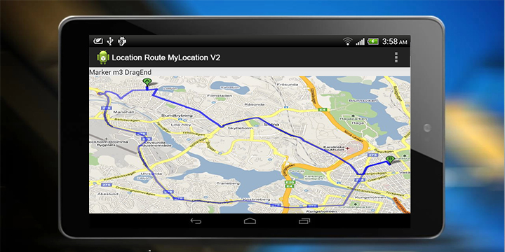
Step 6 :- Run Code.


Leave a Reply